
By Patty Wilber
The campground was good! The riding was amazing!
Me, Amber, Mary Ann and Patty S. spent the last three days horse camping at the Upper Bonito Dispersed Recreational Area in the Lincoln National Forest near Nogal and Ruidoso. This is where the trailheads for the Argentina and Bonito canyons start and lead into the White Mountain Wilderness. I had never been there and I had thought it was called Argentina Bonita.
Many thanks to Marsha Parr for tips and routes that were invaluable!
At the end of road 107, the campground has equestrian sites where you just pull over into a wide spot. Super easy for trailers. There are four sites that have a horse pen with them. There is no trailer length restriction even though one site said there was. The forest service site linked above was not at all helpful but we were able to call and get the information we needed about the campground. I found Marsha on Facebook and she and a trail rider that came into the campground Tuesday provided good trail information that allowed us to plan some fine routes.
The campground was clean, the outhouses were clean, and the campground was patrolled several times a day by uniformed people, but interestingly, often in private vehicles. The forest is in Stage II fire restrictions and our (legal) propane fire ring was checked and verified as fine. That was nice to see! This was a far cry from Jack’s Creek in the Pecos two weeks ago, which was also in Stage II. At Jack’s there were zero patrols and at least five sites with roaring fires.
The horse pens were huge, and would be great for two horses that are buddies, but our animals are not buddies, so we used three pens and highlined one animal. The pens have cement floors covered by rubber mats, but there are just four pens total. There are ample spots to park and highline should the pens be full, but mid-week, we were the only horse campers.
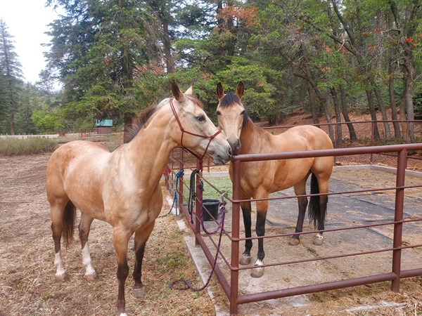
LT (outside) and Zima (inside) agreeing that the pens are nice. LT’s pen can be seen in the background with the pink bucket. It was a little farther from Zima than she wanted to be but she managed alright. On another note, I love how their coats look at this time of year!
We understood it to be a dry camp, and we brought ample water. There is a hand pump at the front of the equestrian area with non-potable water, but I couldn’t get any water to come out of it at all, after about 15 pumps. There is no electricity.
We loved the trails! They were interesting, had some challenging parts, covered varied terrain, and provided great views!
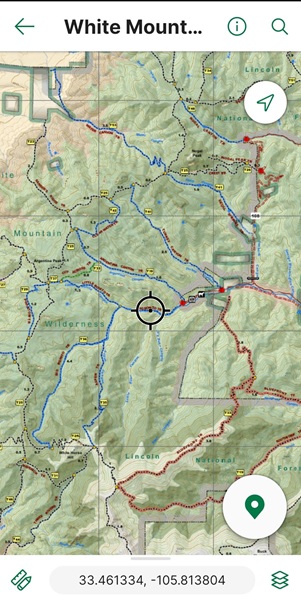

Day 1. 5.1 miles. I talked to the riders that came in and they warned of a treacherous section with a slick rock where horses had fallen on Big Bonita. It was apparently 10 feet long, was near a shear dropoff, and would be much better to go up it than down. We had planned a Big Bonita (36), Little Bonita (37), Cut Across (38), Argentina (39) loop, so we went ahead and did that, figuring we could just see what the bad spot looked like.
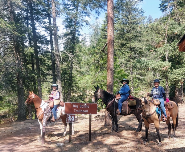
Mary Ann, Amber, and Patty S. at the trailhead at the campground.
The trail is in a forest of big ponderous and other conifers, crosses some small streams, and climbs about 900 feet to the Cut Across. The Cut Across Trail goes through a burn scar and drops steeply down to the Argentina Canyon trail. We kept looking for the treacherous spot and we couldn’t figure out where it was. No 10-foot sections of slick rock that were tough to skirt. No hundred-foot cliffs to fall off. (He did not, in his defense, actually say there was a 100-foot cliff to fall off, but that was kind of what it sounded like…)

Patty S. and Zima on the Cut Across Trail, as it is dropping down to Argentina Canyon.
As we reached the Argentina Canyon, we saw a feral pig trap, which was something we had not seen before. Then we rode the few miles back to camp. A perfect first-day ride, except Amber stayed at at camp to figure out an issue with her living quarters, so she missed it!
Day 2. 12.5 miles. And 4400 feet of elevation gain. Big Bonito (36) to Aspen (35) to Crest (25) to something to the Cut Across (38)–oops–meant to stay on the Crest, but got thrown off track by the sign that pointed to Argentina by way of the Cut Accross–to Argentina (39) (again).
It was a tough climb of nearly 2200 feet the first five miles! We spotted the “treacherous” section on Big Bonita! It was a smooth 1.5-foot wide slab and a 15-foot incline that one could slide off. Apparently, several had. But, it seemed obvious that one should not step on it, and it was really easy to go around. Maybe I was wearing my flamingo bucket hat when I was talking to him and he was afraid we were a bunch of yahoos!

We turned off Big Bonito on to Aspen, and we had intel that there were down trees but all were passable. Turns out there were 20 trees we would have removed if we were working. All were easy enough to step over or to get by. Aspen trail got steeper and steeper and we stopped frequently to let our steeds catch their breath.
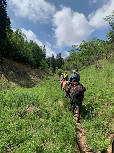
Aspen Trail, lower down. Green! Aspen. oaks, locust, doug fir, ponderosa. Beautiful! Photo by Patty S.
We climbed out of the trees and switched backed up and up across the face of a steep grassy slope. It looked daunting but as we did it, it was not as bad as it looked. As we topped out, the views were fantastic!

LT seems to really like her latest job as my primary backcountry horse! At 15 she is so much more settled than she was as a young cowhorse!
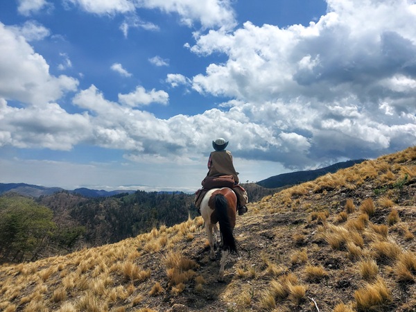
Mary Ann coming to a crucial spot!
We missed a sharp turn about here and started down a trail that started feeling a bit iffy as it was oddly narrow and had no real trail bed Also, there were a number of elk tracks but no horse prints. We stopped and pulled out All Trails (Amber) and Gaia (me) and agreed that we’d missed a sharp right. We back-tracked and found it easily–there was even a cairn, but we’d been overcome by the views!
Once back on the trail, we realized we were not done climbing and we were not done traversing the sides of the sheerish slopes. We did see a cow elk and then five bulls in velvet burst out in front of us. LT startled, but not much. She was much more disturbed by a tiny bird flying out of a bush later on.
We made Crest Trail and had to climb a bit more and then we started down. The five bulls were ahead of us and they ran straight down the steep slope you can see in the photo below. It was fun to see how they moved and kept their balance!
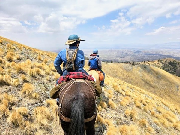
Amber and me. It was windy and a bit chilly. LT felt tired to me at this point after all that climbing. Photo by Mary Ann.
We went down some serious switchbacks (see map) and as the trail curved around there was an oak grove out of the wind that had good trees to tie and views. We enjoyed our lunch there. The bounce in LT’s step returned after lunch and we rode the Crest Trail with its views until were headed down toward the Cut Across, then Argentina and camp. A challenging, beautiful, and satisfying day!
Day 3. 9.9 miles. I had Marsha’s Equilab track, but with no cell signal I couldn’t get it to open on a map that showed the trails, so I matched the shape of the track to my map and figured out the trails. I don’t know which direction she went, but we decided to take road 107, to road 108, to Skull SpringsTrail (41) to the Crest (25) to Clear Water Trail (42) to Argentina (39). We went down Argentina every single day, but this time from the very top!
We knew that 41 was hard to find and sure enough, we missed it because there is no sign on the road and there are private property signs on either side. We pulled out the All Trails and Gaia again and found it. There did not seem to be any designated parking lot, but we were riding, so not a problem. This trail had a different set of plants. It was drier and climbed up through oak groves instead of conifers. Of course, there were nice views at the top!
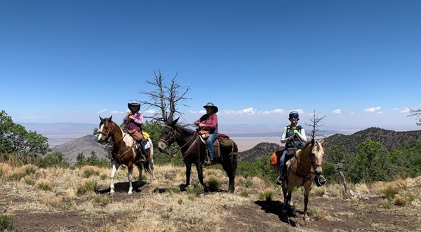
At the top of Skull Springs Trail. Mary Ann, Amber, me. In the distance you can see the black of the Malpais Lava flow that is near Carrizozo, NM. It is about 5000 years old. I thought it was called the McCartys Lava flow, but that is near Grants, NM, and is about 3000 years old. Photo by Patty S.
We followed the Crest Trail to Clear Water Trail. It followed what appeared to be the rim of an old volcano. There were what we think were old sheep pens at points where there were once springs. The water troughs were dry. The Clear Water Trail had a junction with Argentina (our favorite downward route to camp, apparently) and there was a live seep there that the equines appreciated.
We made it down by 1 pm, packed up, ate lunch, and headed home.
Another excellent adventure!
Happy Friday!


